Unfortunately I am unable to take on additional mapping projects at this time. Thank you for your interest.
I live-streamed the desktop production portion of a mapping project in 2022, which can be found below:
Free LiDAR Basemap Processing Scripts
- Free LiDAR basemap processing scripts can be found on my public facing GitHub.
Orienteering Mapping
With over 6 years of orienteering mapping experience on more than 50 projects across Canada, I specialize in remote sprint map drawing but also have experience in fieldwork with forest mapping projects. All my maps are artfully drawn to comply with the relevant IOF standard including ISOM2017-2, ISSprOM2019, and ISSkiOM2019.
My maps have been used for everything from schoolyard trainings all the way up to provincial and territorial championships. In 2022 one of my maps in Cranbrook, BC will be used for the Canadian Orienteering Championships.
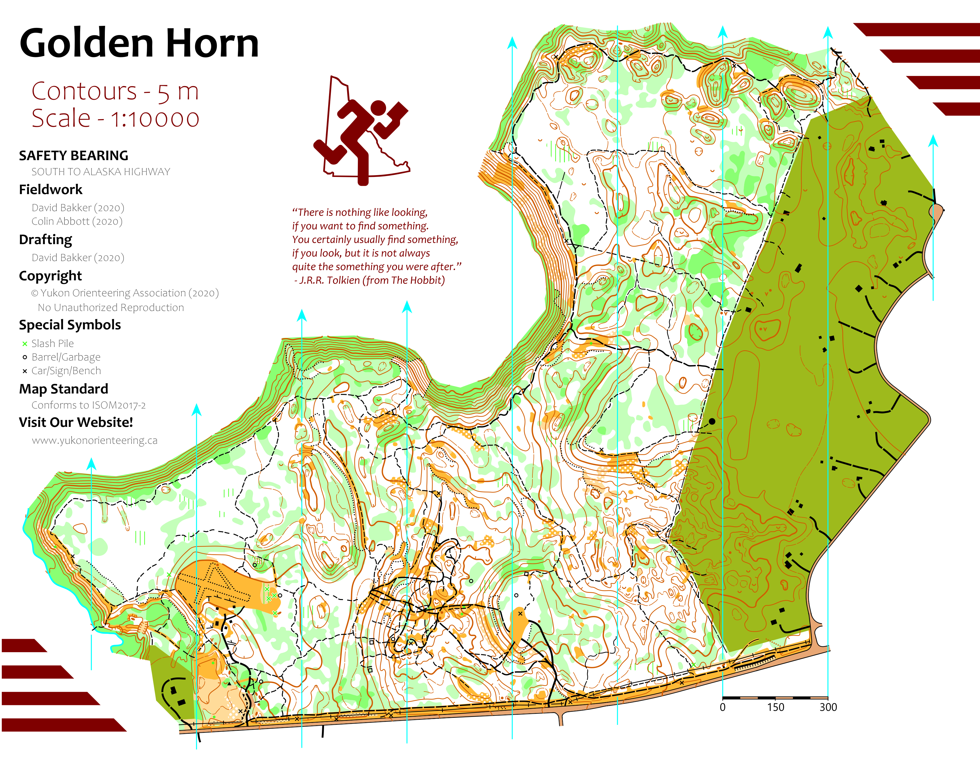
Remote sprint mapping allows me to do all the computer drafting at a distance, with a local individual doing the fieldwork. About 75%-90% of the work is done by me at a distance (depending on how good local data sets are), with only a few hours of work done by a local per map.
I have worked on maps for:
- Orienteering BC
- Yukon Orienteering Association
- Sage Orienteering Club
- Toronto Orienteering Club
- Greater Vancouver Orienteering Club
- Victoria Orienteering Club
- Kootenay Orienteering Club
- Ukrainian Orienteering Club
- Various Individuals’ Private Orienteering Maps
Other Mapping
In addition to extensive orienteering mapping, I also create static scale maps for various companies, events, and groups both in a volunteer and paid role. Mapping projects include:
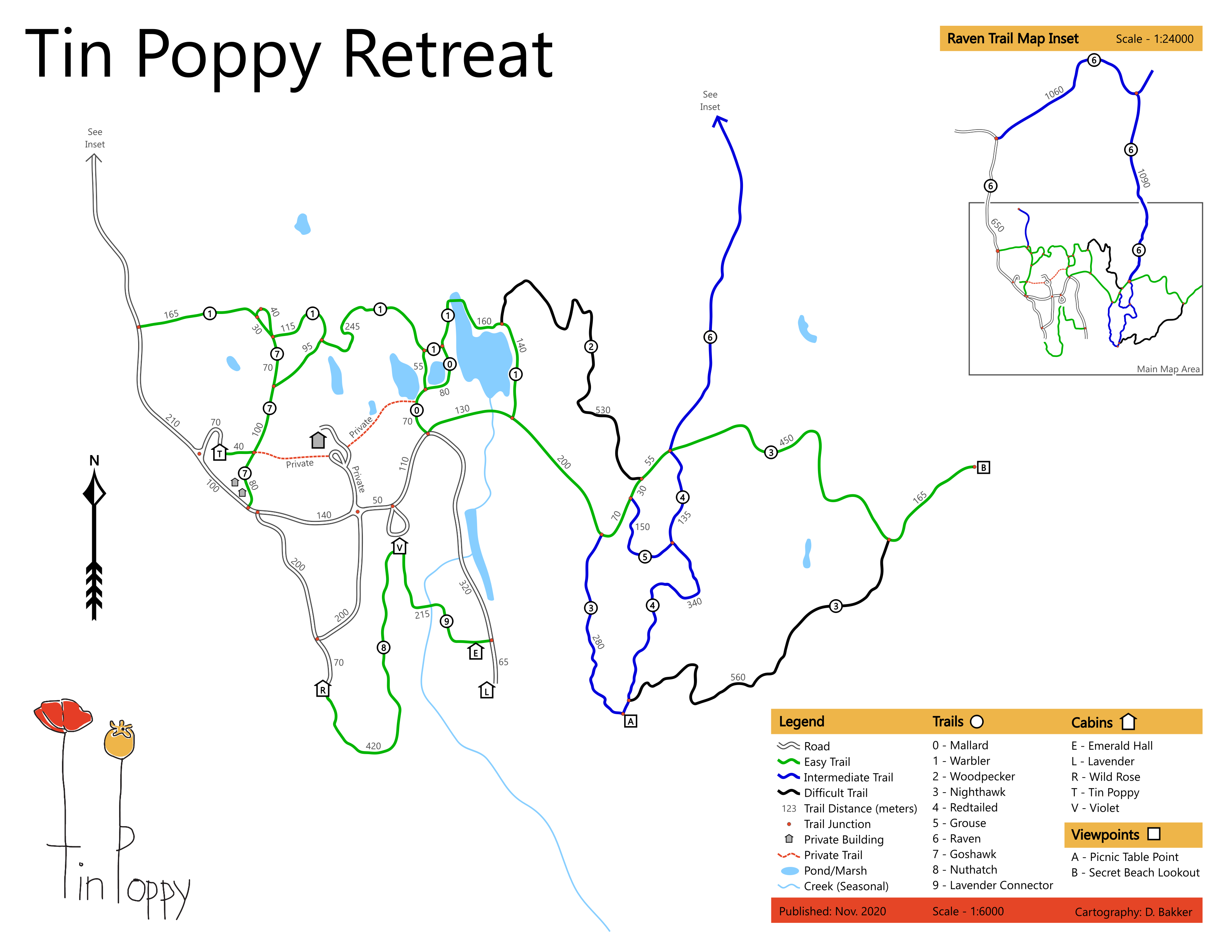
- Tin Poppy Retreat Trail Map
- Reino Run Cross Country Running Race Course Maps
- Various BC Cup and BC Championships Course Maps for the Larch Hills Ski Club
- BC School Sports Cross Country Running Course Maps